PostGIS: Up and Running
Regina Obe and Leo Hsu
Buy our books! at http://www.postgis.us
PGOpen promo codes for 44% off PostGIS In Action 2nd Edition postgrescft
Tutorial material at http://www.postgis.us/pgopen2014
Agenda
Preliminaries
Geometry
Spatial Reference Systems
Geography
Geocoding
3D Geometries
Tantalizing SQL Constructs
Importing Data
Tools of the Trade
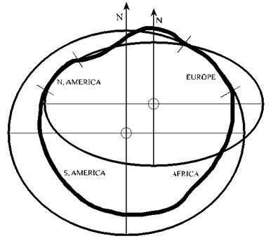
Geoid
Ellipsoid
OS2PGSQL and other OpenStreetMap loaders
Osm2pgsql http://wiki.openstreetmap.org/wiki/Osm2pgsql is one of several tools not packaged with PostGIS but useful for loading OSM data into PostGIS format. Supported on all platforms and was one of the first
Imposm http://imposm.org - another popular for Linux/Mac OSX - no binaries for windows. Many say it is faster than osm2pgsql.
ogr2ogr Part of GDAL toolkit. Binaries available for many platforms and often already installed if you installed PostGIS on Linux.
3D Surfaces
We are using PostGIS ST_AsX3D function combined with http://www.x3dom.org to render some of these in HTML
Warning 3D stuff is still not very tested yet.
Closed Polyhedral Surface
SELECT ST_GeomFromText('POLYHEDRALSURFACE Z(
   ((0 0 0, 0 0 1, 0 1 1, 0 1 0, 0 0 0))
 , ((0 0 0, 0 1 0, 1 1 0, 1 0 0, 0 0 0))
 , ((0 0 0, 1 0 0, 1 0 1, 0 0 1, 0 0 0))
 , ((1 1 0, 1 1 1, 1 0 1, 1 0 0, 1 1 0))
 , ((0 1 0, 0 1 1, 1 1 1, 1 1 0, 0 1 0))
 , ((0 0 1, 1 0 1, 1 1 1, 0 1 1, 0 0 1)) )');
Closed Polyhedral Surface In X3D
SELECT ST_AsX3D('POLYHEDRALSURFACE Z(
   ((0 0 0, 0 0 1, 0 1 1, 0 1 0, 0 0 0))
 , ((0 0 0, 0 1 0, 1 1 0, 1 0 0, 0 0 0))
 , ((0 0 0, 1 0 0, 1 0 1, 0 0 1, 0 0 0))
 , ((1 1 0, 1 1 1, 1 0 1, 1 0 0, 1 1 0))
 , ((0 1 0, 0 1 1, 1 1 1, 1 1 0, 0 1 0))
 , ((0 0 1, 1 0 1, 1 1 1, 0 1 1, 0 0 1)) )'::geometry);
Output Closed PolyhedralSurface with X3D
SELECT '
';Closed TIN
SELECT 'TIN(
            ((0 0 0, 1 0 0, 0 1 0, 0 0 0)),
            ((0 0 0, 1 0 0, 0 0 1, 0 0 0)),
            ((0 0 0, 0 0 1, 0 1 0, 0 0 0)),
            ((0 0 1, 1 0 0, 0 1 0, 0 0 1))
            )'::geometry;
Closed TIN with X3D
SELECT '
'
|| replace(ST_AsX3D('TIN(
((0 0 0, 1 0 0, 0 1 0, 0 0 0)),
((0 0 0, 1 0 0, 0 0 1, 0 0 0)),
((0 0 0, 0 0 1, 0 1 0, 0 0 0)),
((0 0 1, 1 0 0, 0 1 0, 0 0 1))
)'::geometry),
'<IndexedTriangleSet', '<IndexedTriangleSet solid="false" ') || 'Road network in X3D
SELECT string_agg('
', '') As x3d
FROM (SELECT row_number() over(ORDER BY ST_Length(way) DESC) As rn,
name, count(*) OVER() As cnt, way As geom
FROM po.planet_osm_line
WHERE ST_Intersects(ST_Transform(
ST_Buffer(
ST_Point(-87.627,41.8819)::geography,
100)::geometry,900913
) , way) ) As f;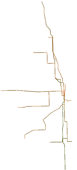
SFCGAL ST_Extrude convert 2D Buildings to 3D
SELECT string_agg('
', '') As x3d
FROM (SELECT row_number() over(ORDER BY ST_Area(p.way) DESC) As rn,
name, count(*) OVER() As cnt, p.way As geom
FROM po.planet_osm_polygon AS p
INNER JOIN (SELECT way FROM po.planet_osm_polygon
WHERE name ILIKE 'Trump%') As ref ON ST_DWithin(ref.way, p.way,150)
WHERE p.building > ''
) As f;SFCGAL ST_Extrude Output

Tiger Geocoder: Loading data
Create copy of a template record
Here I use windows. If on Linux or mac use sh
INSERT INTO tiger.loader_platform(os, declare_sect, pgbin,
	wget, unzip_command, psql, path_sep,
		   loader, environ_set_command, county_process_command)
SELECT 'mydb', declare_sect, pgbin, wget, unzip_command, psql, path_sep,
	   loader, environ_set_command, county_process_command
  FROM tiger.loader_platform
  WHERE os = 'windows';
Use your favorite editor to edit the declare_sect.
Generate Nation files load script
SELECT Loader_Generate_Nation_Script('mydb');Then run the generated script from command line.
Tip 1: to reduce load skip blockgroups
If you don't need tabblocks, block groups, and tracts for statistics, disable load. These aren't used by core geocoder functionality. Disable the load.
UPDATE tiger.loader_lookuptables
	SET load = false WHERE table_name IN('bg', 'tabblock', 'tract');
Generate State load script
SELECT Loader_Generate_Script('{IL}'::text[], 'mydb');Tip 2: Don't need whole state edit down to county
If you don't need a whole state of data, edit the generated script.
For example faces, edges, featnames -- change 17 to 17031 (if just want Cook county)
Then run the generated script from command line.
Install missing indexes and analyze
SELECT Install_Missing_Indexes();don't forget to update stats
analyze verbose;Geocoding
SELECT pprint_addy(addy),
 ST_AsText(ST_SnapToGrid(geomout,0.0001)), rating
FROM geocode('333 North Dearborn Street, Chicago, IL 60654',1);
pprint_addy | st_astext | rating --------------------------------------+-------------------------+-------- 333 N Dearborn St, Chicago, IL 60654 | POINT(-87.6294 41.8885) | 0
Geocoding Intersections
Intersection Name on Lake St
SELECT pprint_addy(addy),
 ST_AsText(ST_SnapToGrid(geomout,0.0001)) As loc, rating
FROM geocode_intersection('Lake', 'Clark', 'IL', 'Chicago');
pprint_addy | loc | rating ----------------------------------+------------------------+-------- 101 W Lake St, Chicago, IL 60601 | POINT(-87.631 41.8857) | 5 100 W Lake St, Chicago, IL 60661 | POINT(-87.631 41.8857) | 5 W Lake St, Chicago, IL | POINT(-87.631 41.8857) | 5
Geocoding Intersections
Intersection Name on Clark St
SELECT pprint_addy(addy),
 ST_AsText(ST_SnapToGrid(geomout,0.0001)) As loc, rating
FROM geocode_intersection('Clark', 'Lake', 'IL', 'Chicago');
pprint_addy | loc | rating -----------------------------------+------------------------+-------- 200 N Clark St, Chicago, IL 60601 | POINT(-87.631 41.8857) | 5 201 N Clark St, Chicago, IL 60601 | POINT(-87.631 41.8857) | 5 198 N Clark St, Chicago, IL 60601 | POINT(-87.631 41.8857) | 5 199 N Clark St, Chicago, IL 60601 | POINT(-87.631 41.8857) | 5
Geocoding Intersections, include zip and num matches
You get better performance if you provide Zip and max returns
SELECT pprint_addy(addy),
 ST_AsText(ST_SnapToGrid(geomout,0.00001)) As loc, rating
FROM geocode_intersection('Clark', 'Lake', 'IL', 'Chicago', '60601', 1);
pprint_addy | loc | rating -----------------------------------+---------------------------+-------- 200 N Clark St, Chicago, IL 60601 | POINT(-87.63098 41.88574) | 5
Reverse Geocoding
addy is an array of possible normalized addresses of a point location. You can expand aliases with unnest.
SELECT pprint_addy(unnest(rc.addy))
 FROM reverse_geocode(ST_Point(-87.63098, 41.88574) ) As rc;
If you are running PostGIS < 2.1.4, you will be missing the directional N.
           pprint_addy
---------------------------------
 102 N Lake St, Chicago, IL 60661
 200 N Clark St, Chicago, IL 60601
Links of Interest
Promo Codes
44% off PostGIS In Action 2nd Edition postgrescft